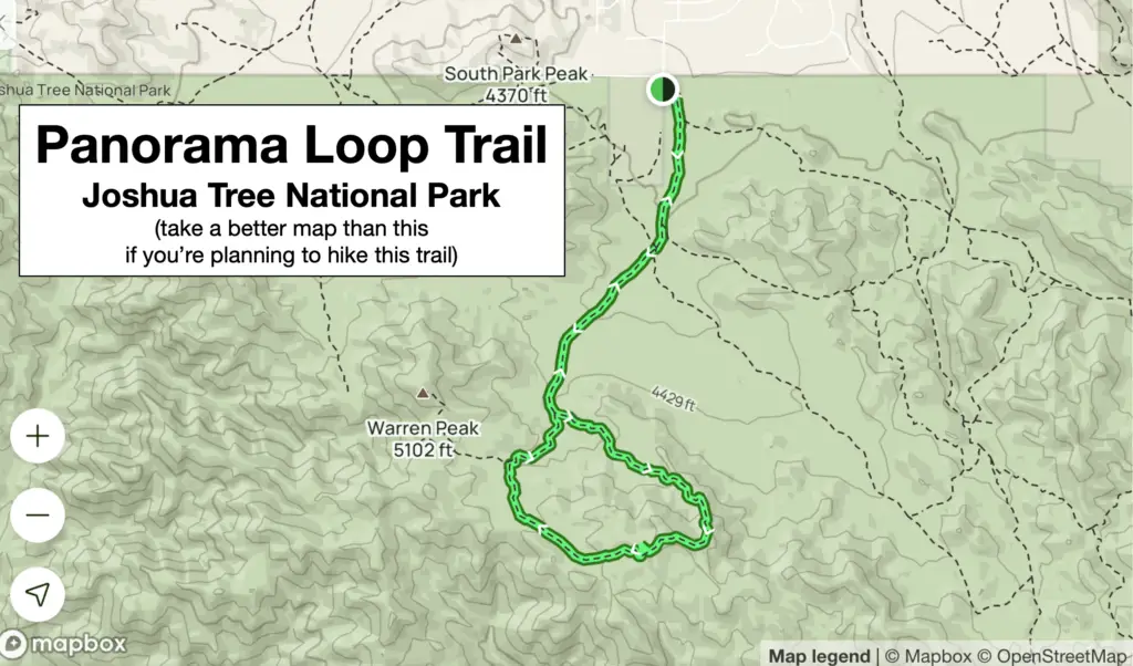
If you’re looking for a hiking trail in Joshua Tree National Park that won’t disappoint, we have three for you. That’s not to say the other trails in the park are not stunning; they are. But having a go-to list in your back pocket helps when time is short, and you want to get in a great hike.
Listen to our podcast episode on Joshua Tree National Park here.
The trails we discuss in this post are not in order of preference. We’ve hiked them all and would love to do them again if we get another chance to visit the park. They are all moderately strenuous when temperatures are mild but can be dangerous on hot, sunny days.
Panorama Loop Trail
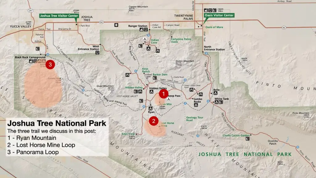
This trail is 6.6 miles and has over 1,000 feet of elevation gain. We’ve fallen in love with this lesser-known trail. The Panorama Loop is a lollypop trail, meaning you hike out on a single trail and then join a circle loop, which later rejoins the original trail. From above, the trail looks like a lollypop.
You begin by hiking up a sandy wash. Keep your eye on the trail markers because you could inadvertently veer off onto the Warren Peak Trail, which wouldn’t be terrible, but that is a different trail than Panorama.
You might want to go counterclockwise
When you reach the loop part of the trail, we suggest hiking it counterclockwise as the clockwise direction is steeper, and we’d rather do the steep sections on the downhill. At the mid-point of the loop, you’ll be on a ridge in the Little San Bernardino Mountains with views of Palm Springs to the west.
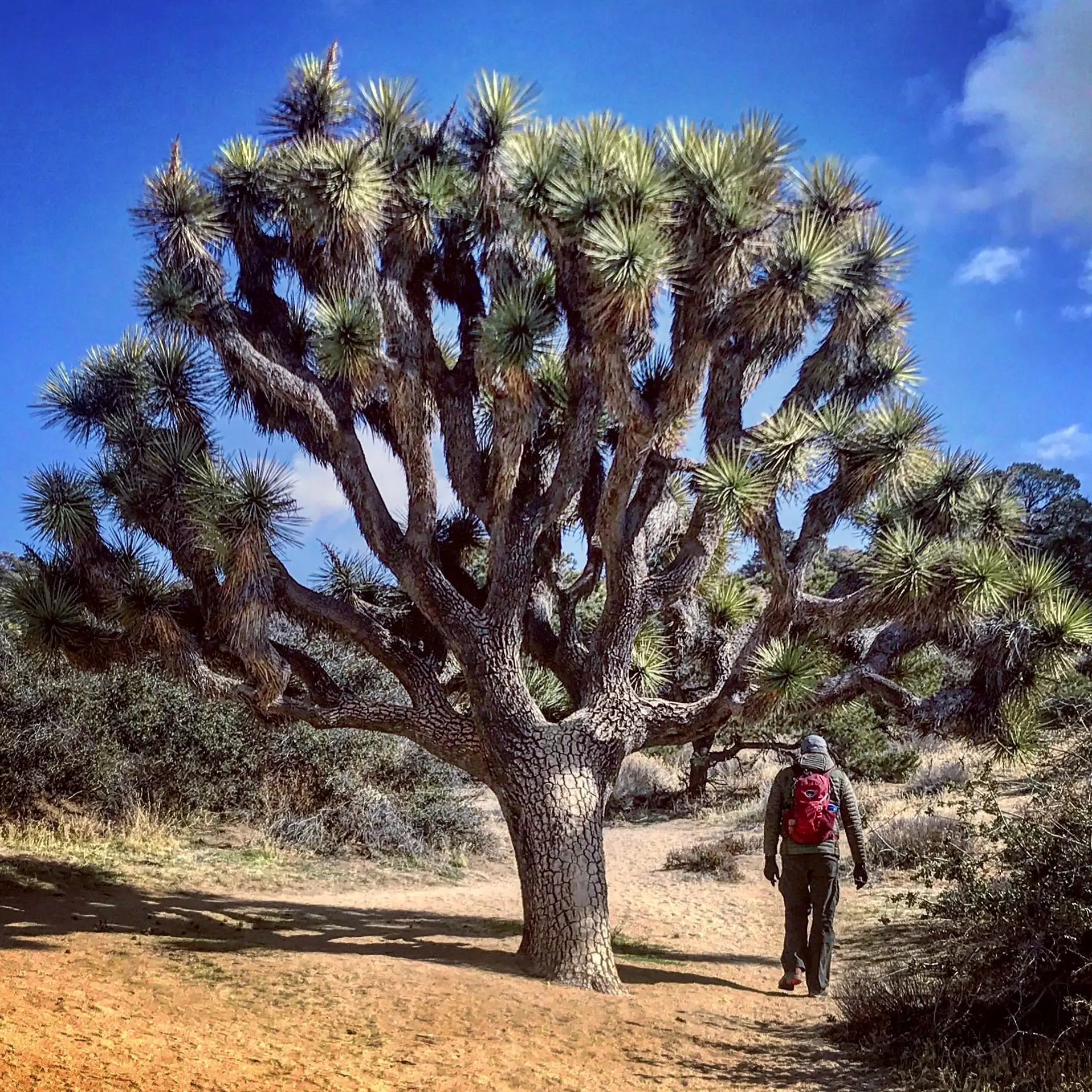
This hike through dense stands of Joshua trees and pinyon-juniper woodland combines vigorous exercise, a beautiful desert landscape, and stunning views.
Bring a good map. Not the one in this post.
Bring a good map when hiking in this area because many trails crisscross and intersect. We always use the GAIA GPS app on our phones, which can track where we are even without cell service.
According to the park’s website
“There are a few parking areas around the Black Rock Campground and Nature Center for hikers. Parking in the campground area can fill up on busy days. Hikers cannot park in a campsite unless they have reserved that campsite. To find the trailhead, hike south from the Black Rock Nature Center, in the uphill direction. At the end of the campground, find the trail sign for panorama loop and start up the washy trail.
This trail has limited shade and unreliable cell service. Always check the weather forecast before heading into the park and consider changing plans if the weather conditions are too extreme. Hikers should always tell a safety buddy where they are going and when they plan on leaving the park.”
Ryan Mountain Trail
The Ryan Mountain Trail is only three miles but will get your heart pumping. While the hike up might take your breath away, so will the views from the top.
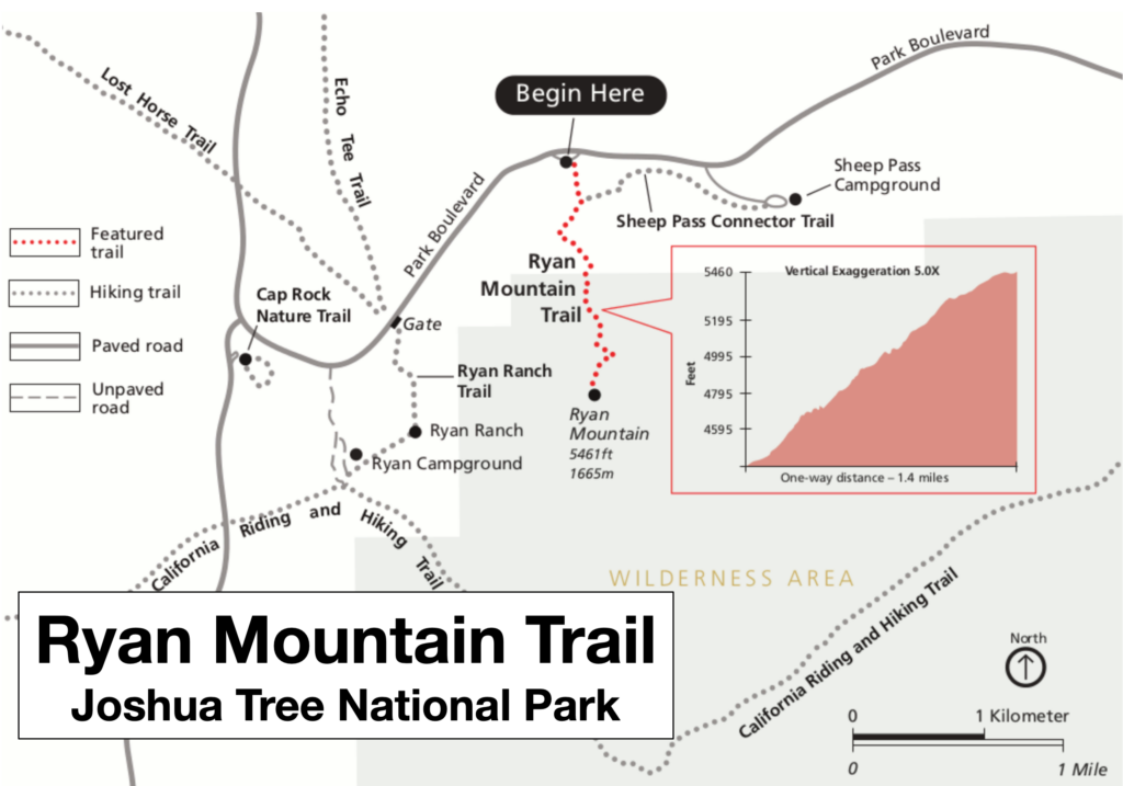
In the center of the northern section of the park, this is a popular trail, meaning you probably won’t be alone on this hike. The hike’s total distance is three miles out and back, but the elevation gain is about 1,050 feet – that’s one way.
Our rule of thumb is that 1,000 feet of elevation gain per mile is about our limit of strenuousness. Ryan comes in below that in steepness, but you’ll know you went for a hike afterward because your legs will remind you.
It’s only a mile-and-a-half to the top
The trail starts alongside towering boulders and steepens, winding up the mountainside on a mix of dirt and granite. Embrace the effort because each switchback unveils more of the stunning landscape: twisted Joshua trees, rugged peaks, and valleys painted in golden hues.
At the top, 360-degree territorial views of the rugged desert landscape below greet you as you look for a place to set down your pack and grab a salty snack. On a clear day, you’ll also be able to spot the snow-capped San Jacinto and San Gorgonio peaks in the distance.
On your return trip to the trailhead, you’ll be reminded that the descent rewards just as much as the climb, offering new perspectives and a chance to soak in the park’s unique beauty.
Lost Horse Mine Loop
The Lost Horse Mine Loop Trail is a moderately challenging 6.7-mile hike that offers stunning views of the desert landscape, a visit to a historic gold mine, and a chance to see unique desert plants and animals.
We love this trail because of the solitude it provides. Even with other hikers on the trail, there are enough twists and turns to give you privacy, so you feel as if you have the place to yourself.
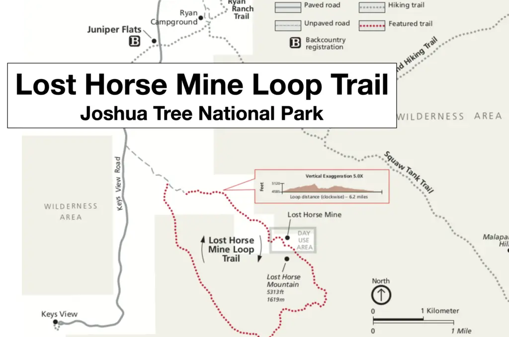
There is an actual mine site on this trail
The trail begins with a gradual climb through a forest of Joshua trees, offering panoramic views of the surrounding mountains. As you continue, the trail gets steeper, leading to the remains of the Lost Horse Mine. This mine operated from 1894 to 1942 and produced over $5 million of gold and silver.
After visiting the mine, the trail continues along the ridge of Lost Horse Mountain, providing even more breathtaking views. You’ll also see interesting rock formations and desert wildflowers along the way.
You might get lucky and see slow-moving wildlife
Keep a lookout for tortoises. These shy residents of the park love to dig in the sand and hang out in their protective cubbies. It’s rare to come across one, yet it is a thrill when you do.
However, do not pick one up! We discuss why in our podcast episode, but it’s bad for their health to touch them. The only exception: if you find one in the road, it’s OK to pick them up and move them out of harm’s way and in the direction of their travel.
The trail eventually descends to the starting point, where you can enjoy the shade of the Joshua trees again.
Remember the essentials
When hiking in the park, remember it is mostly desert and can get warm quickly, even in the winter. Be sure to take the eleven hiking essentials, which include plenty of water and sun protection. For more information on what you should carry on a hike, check out episode #148 of our podcast: Hiking Safety Tips from a National Park Ranger.
To view the entire Joshua Tree National Park map, click here.

