Death Valley, the largest national park in the lower 48 states, is 3.4 million acres of rugged wilderness with a variety of bizarre landscapes: sand dunes, salt flats, mountains, slot canyons, and spring-fed oases.
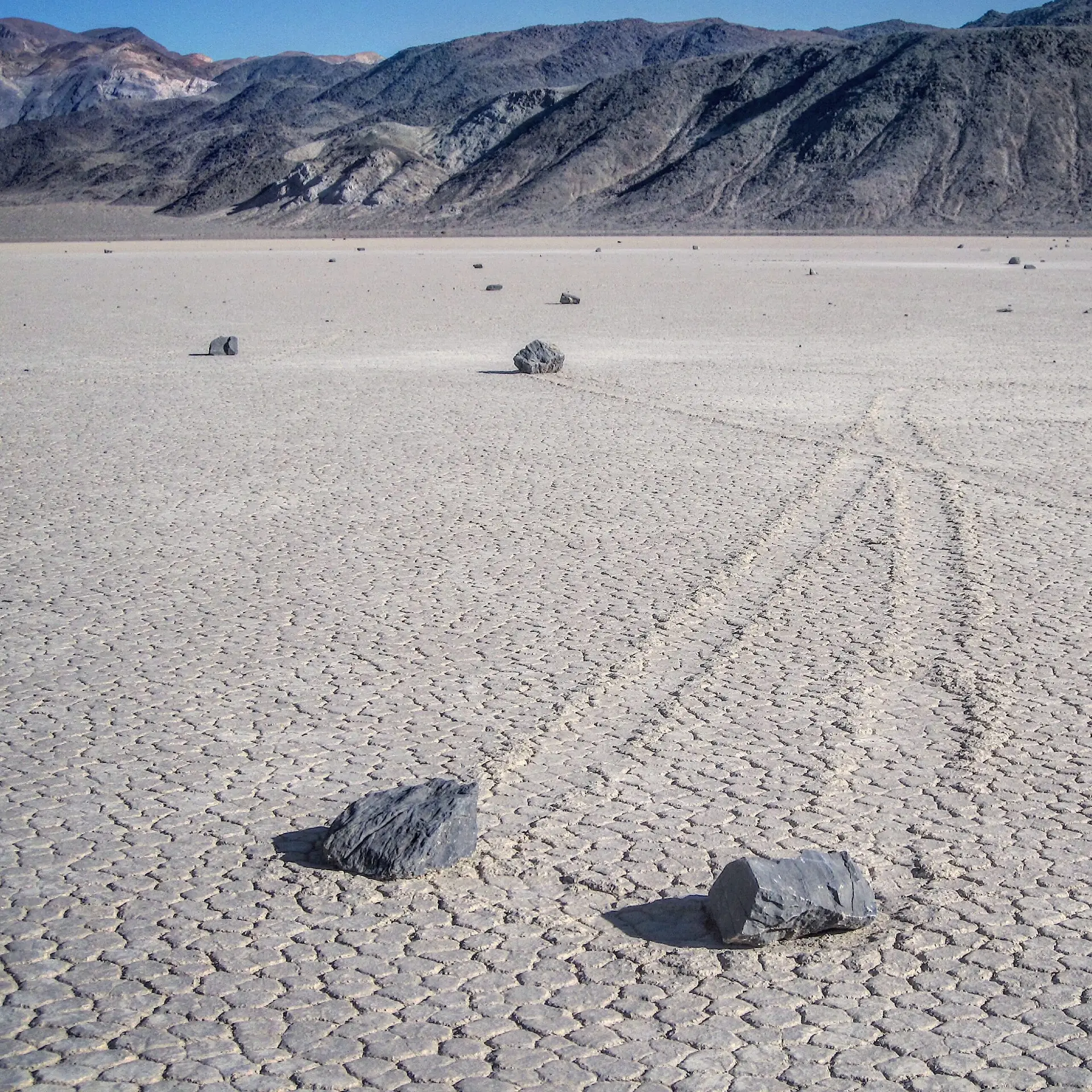
One of the most unusual places we’ve explored in the park is the Racetrack, a dry lakebed where rocks move mysteriously across the surface.
Our first visit was hot and brief.
The first time we saw Death Valley was years ago in late September. We’d meandered eastward around the southern edge of the Sierras earlier that day, seeing the first yellow patches of the fall appear in the mountains; the aspens were beginning to change.
The season may have been changing at higher elevations, yet the Furnace Creek Visitor Center thermometer read 104 degrees. During that visit, it was too hot to do anything but drive through the park, blast the air conditioning, and assure ourselves that we would return.
January is a great time to visit Death Valley National Park.
After a bit of research, we planned our next visit for January. The days are much shorter, but the weather is ideal that time of year: daytime highs average in the 60s with nighttime lows in the 40s.
There’s a greater chance of rain during the winter, but with an average of a quarter of an inch a month, we were willing to take our chances. That trip turned out to be one of our favorite national park visits ever, and each January, we can’t help but wish we were back in the park.
It’s a big park!
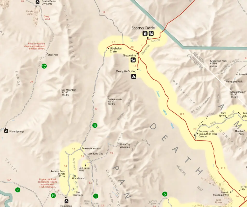
Because Death Valley is so enormous, destinations that seem like a short drive away when looking at the park map may take twice as long as you think. There are only two gas stations within its boundaries, so keeping an eye on your fuel gauge is crucial.
The park’s paved roads are in great shape, but you should have a four-wheel-drive vehicle with good clearance to explore the unpaved roads. The site we looked forward to seeing the most on our January visit, the Racetrack, requires a 28-mile drive on a rough gravel road.
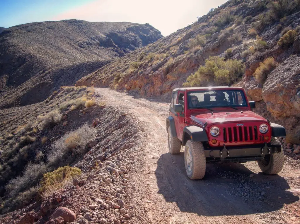
Rent a Jeep if you’re going off road
We decided to rent a Jeep for a couple of days, and as luck would have it, there was a rental company conveniently located inside the park close to the Furnace Creek Visitor Center.
On that week-long trip, we flew to Las Vegas, rented a car at the airport, and drove to the park. When we picked up our Jeep at Farabee’s Jeep Rentals and Tours, the owner, Dick Farabee, assured us we’d made the right decision by renting a vehicle outfitted to handle the conditions of Death Valley’s backcountry roads instead of going off-road in our rental car.
Calling a tow truck will ruin your trip.
He told us that he’d much rather rent someone one of his vehicles than have to go get them out at the Racetrack after they’re stranded with a couple of flat tires. “When they grade that road, it turns up sharp rocks, and most vehicles don’t have sturdy enough tires to withstand those conditions.
I charge $1,000 to tow someone in from the Racetrack, and then they still have to get their vehicle from here back to Vegas or wherever they rented it.” (Note: That’s a conversation from 2011, so prices may have changed since then.)
Don’t be in a hurry on the back roads.
It didn’t take much convincing; we felt much better in one of his Jeeps, especially after we spent two hours bumping along the 28 miles to the Racetrack. (It was an hour’s drive on a paved road from Furnace Creek to the turnoff near Ubehebe Crater, plus another two hours to the Racetrack.)
The math is easy; we rarely went over 15 miles an hour on the one-lane road, and when we did, we nearly shook ourselves silly. We arrived at the playa (an area of dry flat land, in this case, a lakebed) early enough to be the only people there.
For the most up-to-date information about directions to the Racetrack and current conditions, check the park’s website here.
The playa is huge
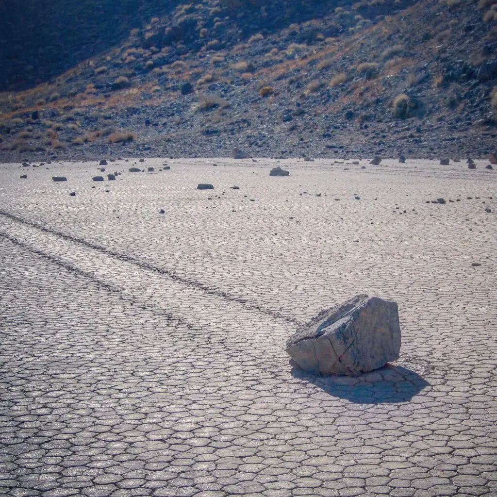
The lakebed is massive: about 2.8 miles long by 1.3 miles wide. From where we parked our Jeep, it was about a half of mile walk to the southeast corner of the playa, where many of the moving rocks were.
Along the way, we occasionally saw a lonesome rock in the middle of the flat, open landscape with a long skid mark trailing off behind it. Most of the rocks were somewhere between the size of a softball and a beachball, but some were larger, looking to weigh at least a hundred pounds or more.
And then there were times we’d see a trail but no rock. Clearly, someone with little regard for this incredible, natural wonder had claimed it as a souvenir.
There can only be one explanation.
For decades, people hypothesized how the rocks move, but since no one had witnessed them traveling across the playa, all the explanations were mere conjecture. Having seen these strange sights up close, we drew the only reasonable conclusion we could: aliens.
Recently, however, the speculation ended when researchers who’d been studying this phenomenon for years happened to be at the lakebed when the rare sequence of events that caused the rocks to move occurred.
Mystery solved
First, enough rain must fall so that the lakebed floods to a depth of several inches. Then, the temperature must drop so that a thin layer of ice forms on top of the lake. Suppose the temperature subsequently rises enough to cause the ice to fracture and melt so that large window panes of ice can float freely on the shallow lake, AND there’s enough wind to move the ice across the water’s surface. In that case, these large panes of ice have enough momentum to push the rocks across the muddy surface of the lake.
While it was discouraging to see that some of the rocks were missing, it’s comforting to know that the phenomenon that causes the rocks to skate across the playa will reoccur, thus refreshing the trails.
It’s time to keep a closer eye on this precious resource.
Although, that could take years or decades to happen. With recent disturbing reports of graffiti and vandalism at the Racetrack, we’d like to see the park initiate a permit process for visiting the site and post a ranger there. This would effectively control traffic and reduce damage, intentional or otherwise, caused by visitors to this fragile environment.
After two hours of exploring the playa, we saw rooster tails of dust approaching from the distance. More cars were coming, and it was time for us to head off to our next destination.
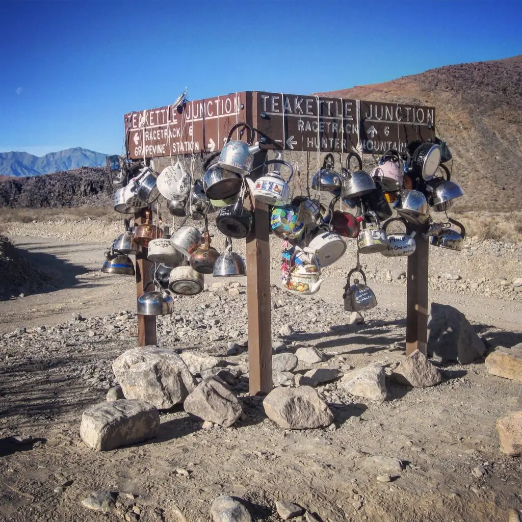
On the way back to the main road, we stopped at Teakettle Junction, about six miles from the Racetrack and just off the main road. It’s become a thing for visitors to leave teakettles with notes hanging from the sign.
So many roads, so little time
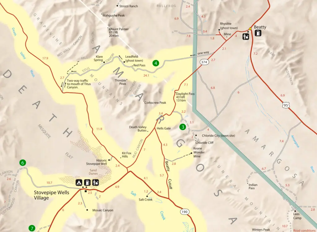
With the other day and a half of our Jeep rental, we explored Ubehebe Crater, Marble Canyon, Hole in the Wall, and our favorite, Titus Canyon. To get to Titus, we drove out of the park toward Beatty, Nevada, turning left before we got there onto Titus Canyon Road.
This one-way, gravel road winds into the hills above Death Valley, taking you past the now-abandoned Leadville ghost town site. We would not recommend driving this road in a rental car due to the roughness of the road, although we saw a couple of sedans out there that looked like they had just come from the Las Vegas rental car center.
Driving through Titus Canyon was amazing.
It’s not a particularly treacherous drive, but you need to pay close attention to the steep drop-offs and grade of the road. Past Leadville, the road descends into Titus Canyon, a beautiful, narrow passage just wide enough for a car to pass through. The drive from paved road to paved road took us about two hours.
(Note: In recent years, the road through Titus Canyon has been closed due to flood damage. Check with the park before making plans to drive this route.)
Watching the sunset from the sand dunes
We ended our off-road days the same way we did most other days in the park: sitting on a sand dune at Mesquite Flats, watching the sunset behind the Panamint Range. (Off Highway 190, less than a mile east of Stovepipe Wells Village).
There are other backcountry roads in Death Valley we’d like to explore someday with a Jeep. But if we were to go back again today, our first stop would be the Racetrack. As difficult as it is to get there, once you’re on the playa, it’s a peaceful place to spend a couple of hours walking amongst the moving rocks.
